I’m excited to announce the release of the beta site for North Carolina Maps, the historic map digitization project by the North Carolina State Archives, UNC-Chapel Hill University Library, and Outer Banks History Center.
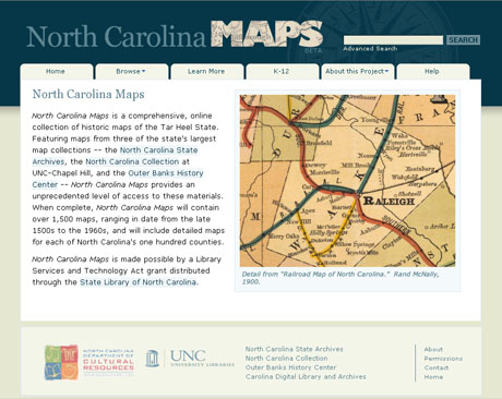
The site currently includes over 750 maps, primarily from the State Archives and the North Carolina Collection. Maps from the Outer Banks History Center will be added in the fall. There is an impressive variety of maps on the site, including many of the earliest maps of North Carolina, state highway maps, Coast and Geodetic Survey maps, and — my personal favorite — soil survey maps. North Carolina Maps also includes at least one map for each of North Carolina’s 100 counties.
New maps and features will be added to the site on a regular basis over the next two years. North Carolina Maps is made possible by a Library Services and Technology Act grant distributed through the State Library of North Carolina.
I have been fiddling around on the map site, and I have to say it truly is impressive. It leads me to think of all of those map cases sitting around the state that might hold one or two or twenty maps that may not be represented on this site yet, especially those that are extremely local, and I can see how this project is only the beginning of what will be an extraordinary resource, and a resource that will generate all sorts of other tools and resources. Think of all the GIS work that can be done. Think of all of the layering of photos and geo-referencing of other online resources.
Way to go, folks!